INDUSTRIES
Agriculture
Farm Management Software Developments
Farm Inventory Management
In order to increase visibility, we integrate GIS technologies, RFID systems, barcodes, serial number ID scanners, and other systems.
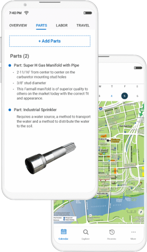
Farm Equipment Servicing
We create agricultural GIS equipment inspection software with mobile applications for in-field inspections and customizable reporting options.
Crop Planning & Tending
Through farm mapping software, we create features that automate watering, irrigation, and planting optimization for better crop planning and tending.
Labor Management Software
We develop software for field operations and labor management that makes it easier to plan, report, and track employees' movements in the field.
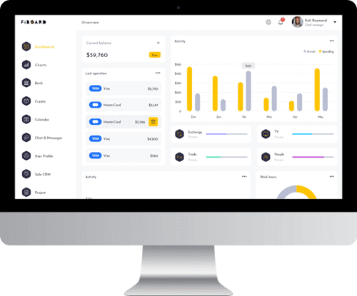
Farm Accounting Software
o compute profit and cost-of-goods-sold, we integrate third-party accounting software with already-existing farming business processes (COGS).
Mobile Farm Management
For enabling farmers to remotely access data analytics, surveillance systems, and other controls, we build farm management apps that operate without a hitch on Android and iOS smartphones.
Agribusiness Software
We interact with CRM software programs to speed lead conversion procedures, obtain behavioral insights, and automate the marketing and social media processes.
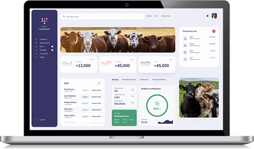
Livestock Management Software Development
Livestock Breeding Software
We incorporate livestock auction systems with customisable user interfaces, as well as livestock dashboards for monitoring herd-wide propagation, genealogy & lineage, and gestation statuses.
Livestock Inventory Software
To obtain complete control and insight over your inventory and manage fluctuating retail & wholesale prices, we build automated livestock inventory software.
Livestock Tracking Software
We use RFID, EID, and embedded ear tag sensors to track cattle positions from the ranch through delivery while integrating with third-party GIS/GPS mapping interfaces.
Cattle Management Software
We develop software for cattle management that can predict stocking rates, carry out pre-planned grazing, contrast pasture production data, generate reports, and much more.
Animal Husbandry Software
Our husbandry program enables farmers to map fertility, fertilization, and soil nutrient levels while managing their efforts to selectively breed and raise cattle.
Feed Mill Automation
We create technologies for feed management software that combine audit trail software to preserve VFD compliance while optimizing the nutrient intake of ranch and agricultural cattle.
Pasture Grazing Systems
Our systems record annual pasture growth and field yields, and they are designed with GIS and geo-fencing technology to produce detailed field views of herd movements.
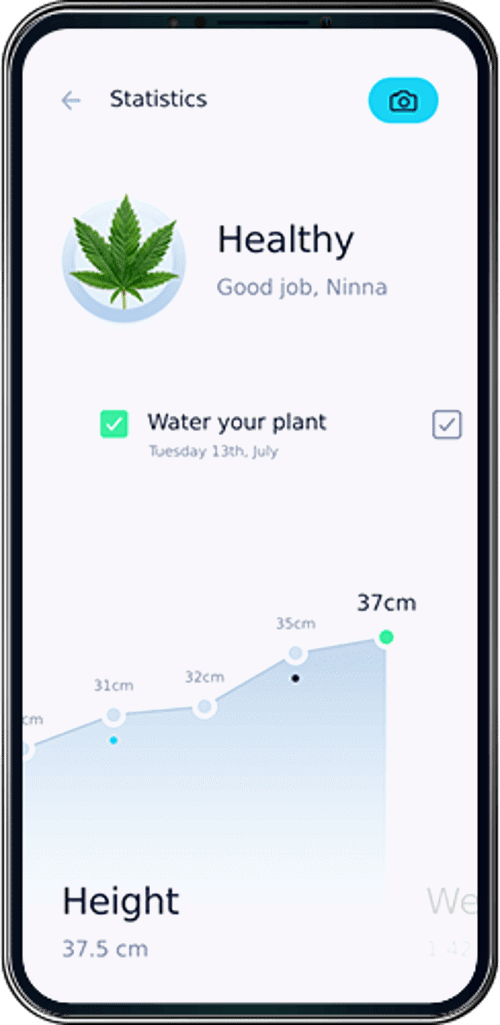
Seed-To-Sale Software Development Services
Cannabis Dispensary Software
We set up specialized connections to software APIs and providers for dispensaries.
Dispensary CRM Solutions
Business intelligence analytics are made possible by the sales, marketing, and customer service tools we engineer into our dispensary CRM platforms.
Dispensary POS Systems
We incorporate role-based access controls for QR and barcode ID scanner software for dispensary point of sale apps and e-commerce websites.
Mobile Cannabis Applications
To create mobile applications for cannabis dispensaries that enable delivery driver tracking, transportation management, and other features, we use open-source geolocation APIs.
Seed-to-Sale Tracking Software
We create seed-to-sale tracking software that covers the whole logistics and shipping process, from the production of raw materials to the electronic evidence of delivery.
Cannabis E-Commerce Solutions
Digital storefronts and shopping carts for our cannabis e-commerce solutions were created by utilizing well-known platforms.
Cannabis Patient Management
E-prescriptions, insurance, electronic medical records, and other patient documents are integrated into patient management software.
Precision Agriculture Software Development Services
Agriculture Monitoring Systems
In order to enable farmers to observe crop impacts in real-time, we integrate agriculture monitoring devices, camera surveillance, data analytics, irrigation systems, and more.
Agriculture Software Integrations
Through a series of API connections, we link soil-mapping, crop sensor, drone, and data analytics software to offer better insights and support interoperability.
Agriculture Soil Sensors
Farmers can detect temperatures, pH balances, moisture & humidity levels, nutrients, and much more thanks to our specially designed soil sensor software.
Agriculture Precision Farming Apps
We scale and adapt agriculture ERP application systems, ensuring full-stack, end-to-end engineering and design of the infrastructure supporting AG farming applications.
Agriculture Drone Software Development Services
Agricultural Drone Development Platforms
Our drone systems are programmed to allow remote sensor network software controls for AG asset health assessments.
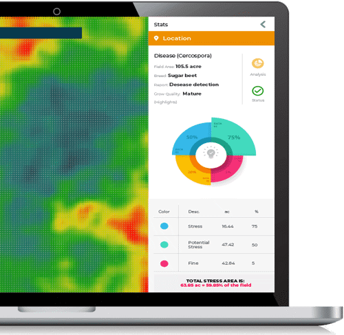
Agricultural Drone Analysis Technology
To assess crop health, we integrate drone software systems with built-in normalized difference vegetation index indicators.
Agricultural Drone Field Mapping
We create AG drone 3D mapping software for farmers using electromagnetic, acoustic, and optical sensors from the ground.
UAV Data Processing Software
Our program for processing UAV data integrates 3D modeling APIs for processing drone images and offers orthomosaic stitching for AG mapping.
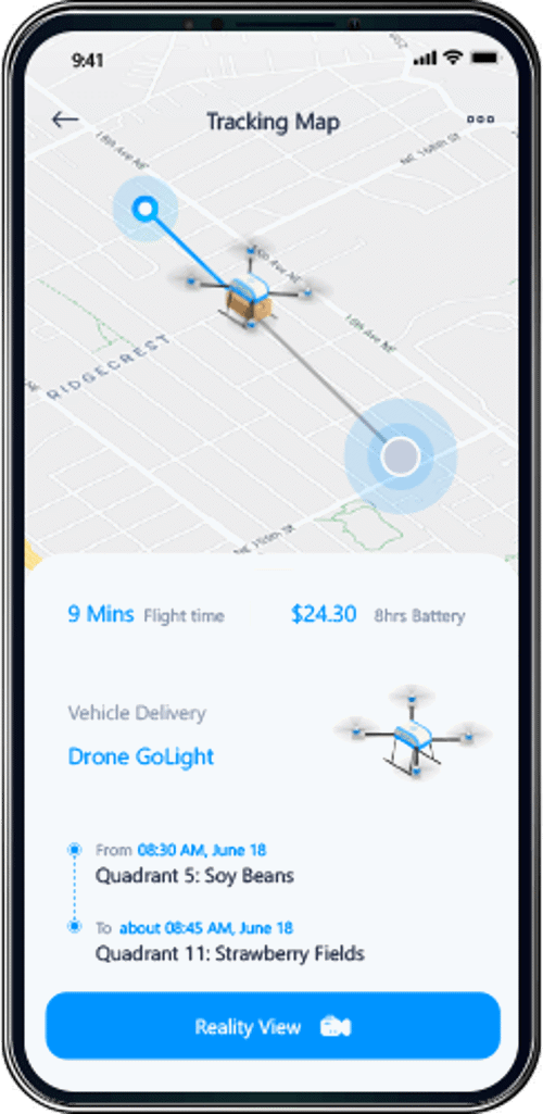
UAV Livestock Software
Our livestock UAV software helps you to locate and monitor your entire livestock inventory remotely while incorporating GPS tagging and thermal recognition.
Smart Farming System Solutions
We develop automated equipment and agricultural oT devices using cellular connectivity, GPS mapping and robotic process automation tools.
Aerial Crop Scouting Solutions
In order to scout and identify soil variation, irrigation problems, and crop infestation, we develop software and aerial sensor technologies for aerial crop imaging.
Aquaculture Software Solutions
Aquaculture Application Development
We create software that provides automated spatial analytics to get precise, thorough, and in-depth understanding of data taken from marine information systems.
Aquaculture Management Systems
We create desktop and mobile aquaculture apps to efficiently manage processes involved in aquaponics and aquafarming.
Fish Farm Management Software
We create and implement fish farming technologies that monitor aquatic lifecycles from the hatchery all the way to the point at which your fish farm is ready for harvest
Aquaculture ERP Integrations
We integrate workflow management solutions to optimize personnel operations and integrate ERP software to perform cost analysis while making adjustments in real-time.
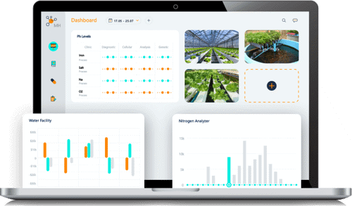
Aquaculture Sensor Technology
We program embedded sensors to monitor and control facility salinity, pH balances, oxidation-reduction potential (ORP), air pressure, and other variables.
Aquaculture Data Analysis Tools
We enhance behavioral assessments of fish populations at the individual, batch, site, breed, and operation-wide levels by utilizing best-in-class sensors and artificial intelligence (AI) techniques.
Aquaculture Monitoring Systems
For improved data sharing and real-time aquaculture data monitoring & traceability, we leverage the cutting-edge capability of electronic data interchange (EDI) connections.